 Parler
 Gab
Gab
All eyes are on Lee's path
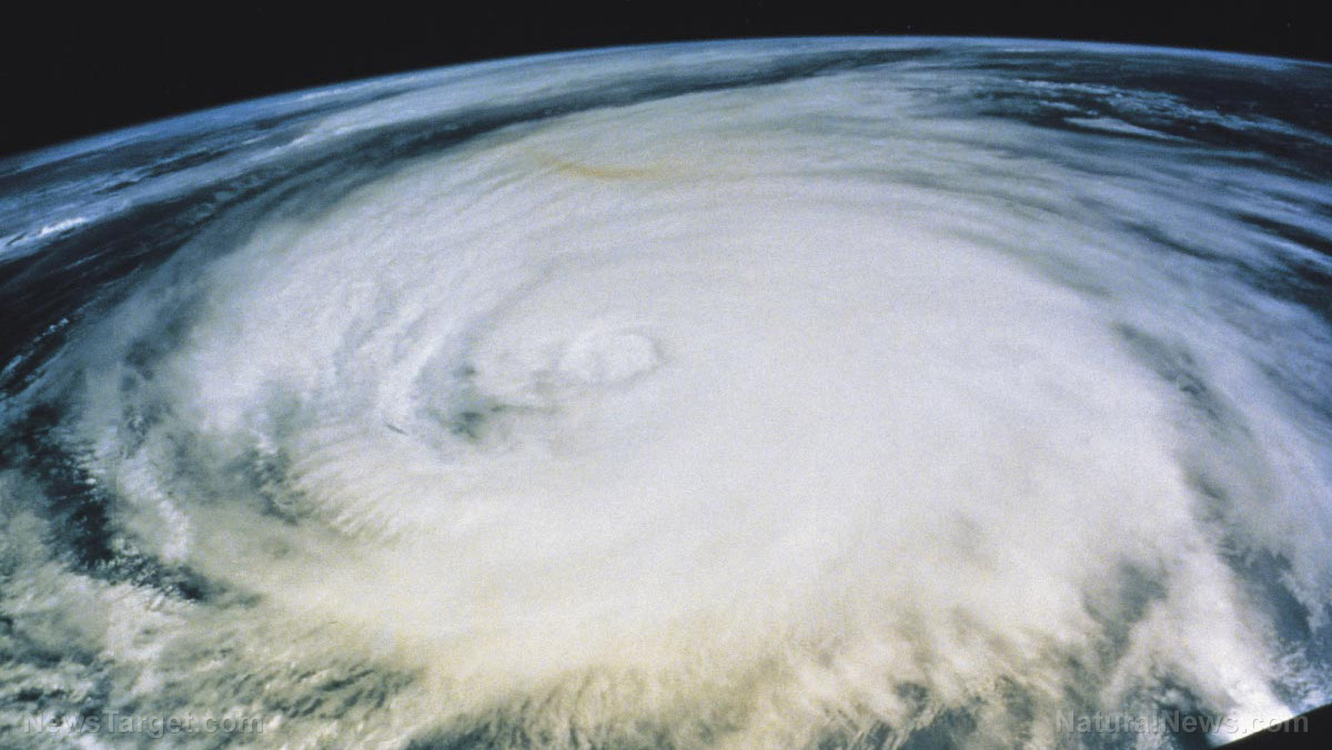
It's too early to say with certainty whether Lee might make landfall anywhere, or if it will spin harmlessly away from the U.S. Atlantic coast and other land masses. Several long-range models currently have Lee eventually curving north, missing the Caribbean and remaining offshore. While models are generally accurate, they're not perfect. In 2017, Hurricane Irma was supposed to follow a similar path – instead, it walloped Florida's Gulf coast. Even if Lee misses land, forecasters say swells generated by the storm "are expected to reach portions of the Lesser Antilles on Friday, Sept. 8, and the British and U.S. Virgin Islands and Puerto Rico this weekend. These swells are likely to cause life-threatening surf and rip current conditions." The system has been gaining power as it passes over "record-warm waters of near [86 degrees Fahrenheit] east of the Lesser Antilles," the NHC said. It added that such warm waters are more expected in the Gulf of Mexico, not the Atlantic Ocean. "The peak of hurricane season is September 10 so it's an excellent time all up and down the East Coast of the United States to recheck your family's preparedness plan and know what you might do if a storm was approaching your community," Kelly Godsey, a senior service hydrologist and meteorologist with the National Weather Service (NWS) in Tallahassee, Florida, told Newsweek.Tropical storm Margot
Tropical Storm Margot also formed Thursday afternoon over the eastern tropical Atlantic, with wind speeds of 40 mph and traveling west-northwest at 17 mph. Margot was still just a depression Thursday morning but is expected to continue to strengthen as it's forecasted to turn north into the central Atlantic Ocean. "Gradual strengthening is expected during the next several days, and the depression is forecast to become a tropical storm later today or tonight," said hurricane specialist David Zelinsky. Another system a few hundred miles west-northwest of Spain is associated with the remnants of Hurricane Franklin. Forecasters said the system is not likely to develop as it heads for harsh conditions and is not currently a threat to South Florida. Visit Disaster.news for more stories like this. Watch the following video about West Coast tropical storm Hilary slamming Southern California. This video is from the InfoWarsSideBand channel on Brighteon.com.More related stories:
Biden declares state of emergency in Florida as Tropical Storm Idalia approaches. Federal government may have "weaponized" Hurricane Ian to magnify climate change narrative. US government has ability to manipulate hurricanes, 50-year-old documentation shows. Sources include: UPI.com NHC.NOAA.gov NPR.org Newsweek.com NOLA.com Brighteon.com3 Suspicious narratives behind the big push toward electric vehicles
By Zoey Sky // Share
Catastrophic FLOODING in Libya kills more than 5k, 10K more still missing
By Kevin Hughes // Share
Panama Canal traffic nearly HALTED due to “drought,” global supply chain NIGHTMARE to unfold
By Ethan Huff // Share
France suspends iPhone 12 sales over concerns of high electromagnetic radiation emissions
By Olivia Cook // Share
Governments continue to obscure COVID-19 vaccine data amid rising concerns over excess deaths
By patricklewis // Share
Tech giant Microsoft backs EXTINCTION with its support of carbon capture programs
By ramontomeydw // Share
Germany to resume arms exports to Israel despite repeated ceasefire violations
By isabelle // Share


